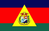
Caratinga
 |
 |
The municipality is located at 19° 37’ 30’’ latitude south and at 42° 09’ 00’’ longitude west. It is part of Region VIII, denominated Rio Doce, and part of the microregion of Mata de Caratinga, in the eastern part of Minas Gerais.
It lies on the important Rio-Bahia interstate highway (BR 116) and is connected to the state capital of Belo Horizonte by BR–381 to the city of João Monlevade. After João Monlevade there is a federal highway, BR 262, which leads into the capital. The state capital lies at a distance of 320 km. The nearest airport is in Ubaporanga 15 km from downtown, tarmacked runway 1200 m long and 20 m wide.
The main rivers that cross the municipality are the Caratinga River and its tributary Laje, the Manhuaçu and the Preto.
Map - Caratinga
Map
Country - Brazil
Currency / Language
| ISO | Currency | Symbol | Significant figures |
|---|---|---|---|
| BRL | Brazilian real | R$ | 2 |
| ISO | Language |
|---|---|
| EN | English language |
| FR | French language |
| PT | Portuguese language |
| ES | Spanish language |


